The Sonoran Joint Venture has been supporting long-term ecological monitoring for decades. This spring we partnered with the Tucson Audubon Society (TAS) and the Bureau of Land Management (BLM) to revive a Monitoring Avian Productivity and Survivorship (MAPS) bird banding station in the Las Cienegas National Conservation Area in southeast Arizona. This station was previously operated by the BLM from 2003 to 2019. With the onset of the COVID pandemic and staff retirements, the station was closed until spring 2023.

The MAPS banding station in the Las Cienegas National Conservation Area is nestled along a riparian zone (photo by Emily Clark).
The MAPS program is administered by The Institute for Bird Populations (IBP). It is a network of bird banding stations that collect data on vital rates of birds (like productivity, recruitment, and survival of individual bird species). As IBP explains, “Most avian monitoring programs count or estimate numbers of birds to track changes in population. Estimates of population trends are useful but limited in their capacity to reveal underlying causes of observed trends in population sizes. [Collecting vital rates] helps scientists understand which life-stages may be most important in limiting population growth or causing declines”.The program has been running since 1989, now with about 300 MAPS stations across North America that operate every spring and over 1,300 that have operated since the program started. To monitor the important wintering period, IBP administers the complementary MoSI (Monitoreo Sobrevivencia Invernal) program throughout Latin America (learn about MOSI).
A MAPS station is operated once every ten days during the breeding season. Ten mist nets are placed throughout the study area before dawn. When birds are captured, they are quickly and carefully processed to collect data on the species, age, sex, reproductive status, molt information, wing wear and length, weight, and other information. Birds are then given a small uniquely numbered aluminum leg band and released safely. When recaptured, we can learn about survival, lifespans, population, and rates of reproduction. Occasionally, banded birds are recovered in other areas which gives us valuable information on movement but is not the ultimate purpose of the data we collect.
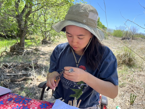
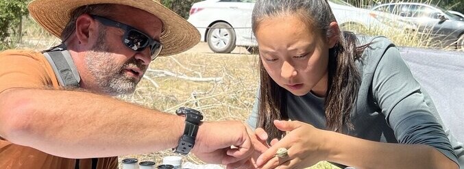
TAS Restoration Project Manager, Aya Pickett, carefully applies a band to a Lucy’s Warbler (photo by Emily Clark).
“Examining vital rates can enhance the effectiveness of conservation efforts so that limited conservation dollars can be directed to the times and places in the annual cycle where they are most needed”. Long-term banding data can help us learn about how important specific areas are for the conservation of birds, such as the studies done on molt-migration in our region. Other applications include causes of population declines, physiological change, habitat connections, and effects of climate change. “IBP and collaborators have published more than 100 peer-reviewed papers and hundreds of reports on the vital rates of landbirds, and their relationships to climate, habitat, land management actions and other environmental variables.”
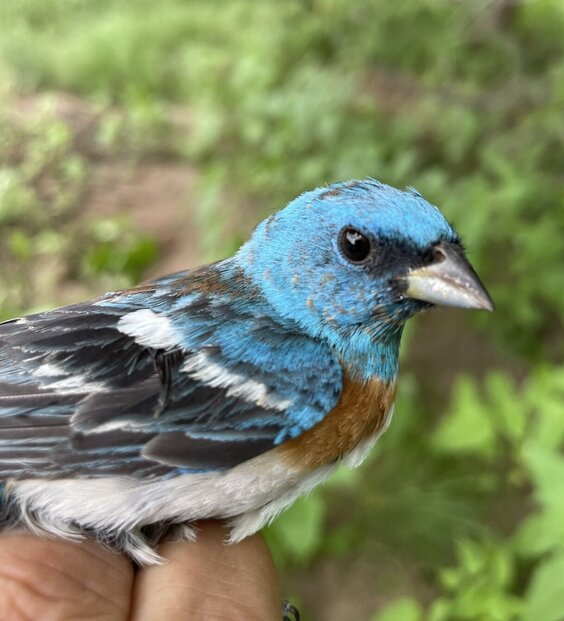
This brightly colored male Lazuli Bunting was an end of the banding season treat (photo by Adam Hannuksela).
In the last issue of the SJV eBulletin, IBP shared with us the development of the MAPS Data Exploration Tool. This new web application makes it easier for researchers to use the data and for everyone to understand how bird populations are faring.
By restarting the MAPS station in the Las Cienegas National Conservation Area, the partnership between the SJV, TAS, and BLM will expand the capacity of banders in the region by providing training opportunities in bird banding. TAS also has plans to expand the MAPS network by starting additional stations in southern Arizona. This collaborative training and banding program will also support the regional Motus network by training banders to apply Motus tags and conducting studies that will take advantage of Motus stations in our region and throughout western North America. In the future, TAS plans to open banding days for the public to learn more about the process. All banding, marking, and sampling is being conducted under a federally authorized Bird Banding Permit issued by the U.S. Geological Survey’s Bird Banding Laboratory. If you would like to become involved, please reach out to Adam Hannuksela.
This article was originally published by the Sonoran Joint Venture and is reposted with permission.